At Green Vision Consultants, we provide end-to-end geospatial and environmental design services from raw data collection and GIS analysis to finished cartographic and environmental graphics. Whether it’s a large-scale infrastructure project or a site-specific wayfinding system, we combine technical precision with clear visual communication to transform complex spatial data into clear, meaningful, and user-friendly design solutions.
We work across a wide range of sectors including public transportation, aviation, municipal planning, and urban infrastructure delivering accurate, up-to-date mapping solutions that support both operational efficiency and public usability.
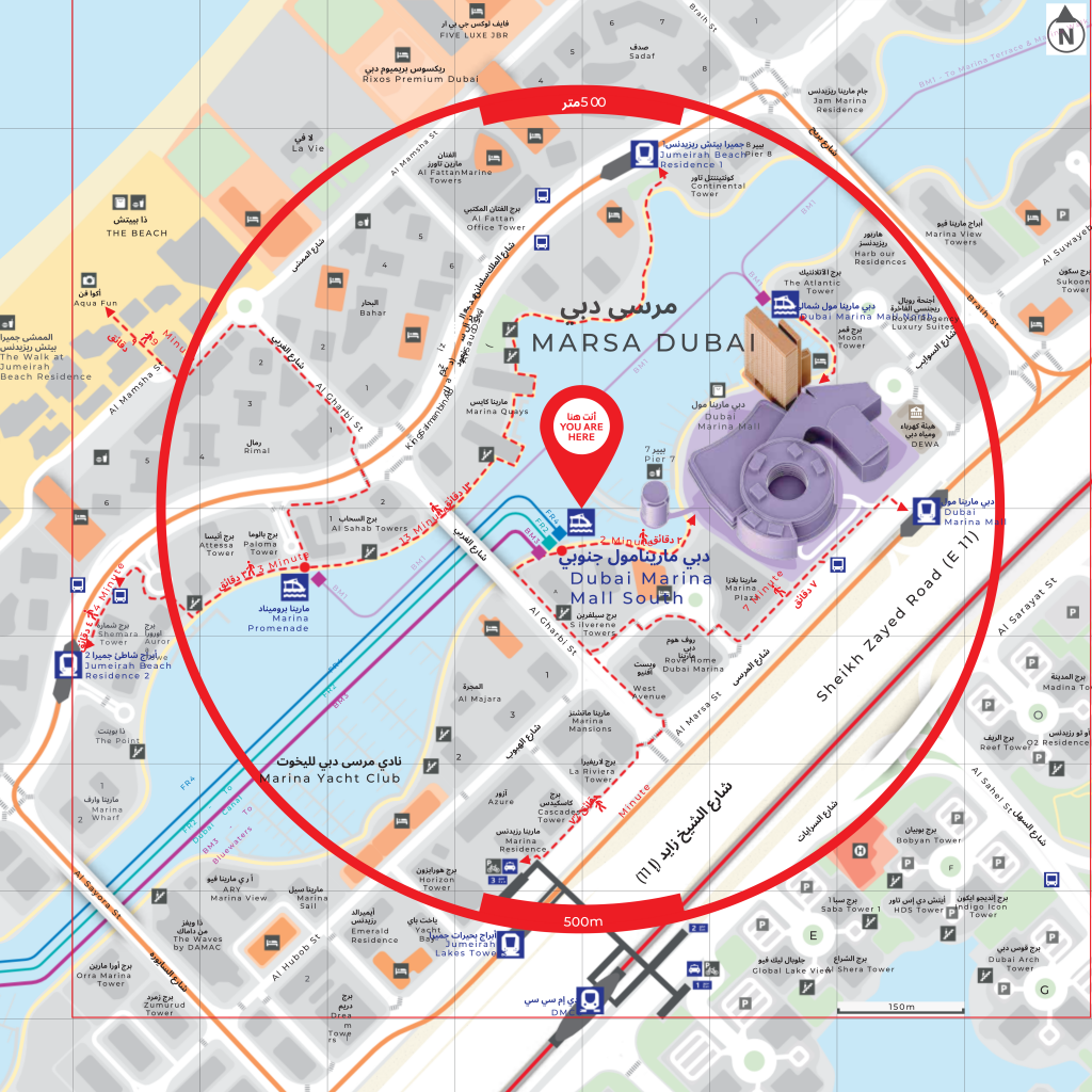
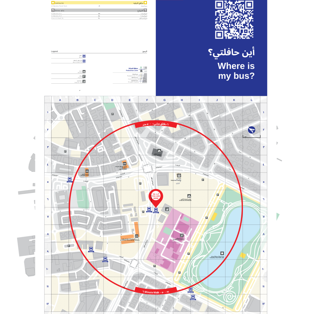
“Wayfinding and passenger information system designed for Dubai RTA bus stop infrastructure.”
Custom 2D and 3D maps developed for print, signage systems, digital platforms, and public installations with a strong focus on clarity, accuracy, and visual communication.
Advanced spatial data processing, analysis, layering, and visualization using industry-standard platforms such as ArcGIS, QGIS, and related GIS technologies.
Comprehensive on-ground surveys to identify key landmarks, infrastructure assets, accessibility points, and surrounding facilities within defined project radii.
Design and development of “You Are Here” maps, transit stop signage, directional systems, and proximity mapping to improve navigation and user experience.
Identification, classification, and mapping of essential destinations including government buildings, educational institutions, hospitals, transport hubs, commercial areas, and community facilities.
Integrated signage systems, public information graphics, and spatial communication design tailored for built environments and public infrastructure projects.
Geospatial planning and visual mapping solutions for metro, train, tram, bus, ferry, and aviation sectors including route maps, network diagrams, and passenger information systems.
Comprehensive mapping and geospatial audit services for municipalities, urban authorities, and government entities requiring infrastructure mapping, urban analysis, map modernization, or periodic updates.
We partner with public and private sector organizations across transportation, aviation, and urban development sectors, including:
For project and general inquiries, please drop us an email.
We shall try and revert back to you within 24 hours.